A common oversight among developers in Hervey Bay is assuming that a gentle slope near the waterfront poses no risk. But the area's sandy soils overlying clay layers can fail abruptly after heavy rain, turning a routine site into a debris flow corridor. Without a dedicated analysis, the mixture of water, soil, and vegetation can travel downslope with enough force to undermine foundations and block drainage networks. Our team has seen several estates near Urangan where post-construction grading altered natural drainage paths, concentrating runoff and triggering unexpected debris surges. That is why we insist on combining field reconnaissance with laboratory testing before any earthworks begin. Where the site shows evidence of old flow paths, we recommend pairing this analysis with a stability assessment to quantify residual risk, and with surface erosion modeling to predict long-term soil loss under intense storms.
A single 1-in-100-year storm in Hervey Bay can mobilise over 800 cubic metres of colluvium from a 2-hectare catchment.
Service characteristics in Hervey Bay
Critical ground factors in Hervey Bay
In Hervey Bay, many times we see that developers clear vegetation from a slope to improve the view, not realising that tree roots were the only thing holding the colluvium together. Once the roots decay, the soil loses cohesion and the first heavy downpour can turn the entire hillside into a debris flow. Another hidden risk is the presence of old drainage channels that have been filled with loose sand during previous construction phases. These buried channels act as preferential flow paths, concentrating water and triggering failure where nobody expected it. Without a debris flow analysis that includes a thorough review of historical aerial imagery and a walkover survey, these legacy features remain invisible until they fail.
Our services
We offer two complementary debris flow analysis packages tailored to Hervey Bay's coastal and hinterland conditions.
Quantitative Debris Flow Risk Assessment
A full desk study followed by field mapping of source zones, transport paths, and deposition fans. Includes ring-shear testing, numerical runout modelling (FLO-2D or RAMMS), and a hazard zoning map. Ideal for subdivisions on the escarpments above Point Vernon and Scarness.
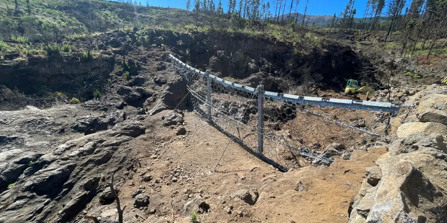
Post-Storm Debris Flow Inspection and Monitoring
Rapid deployment after a severe weather event to assess new scarps, tension cracks, and sediment accumulation. Uses drone surveys and in-situ moisture profiling to decide if emergency drainage or slope flattening is needed. Common for existing properties in the Torquay hinterland.
Frequently asked questions
What is the difference between a landslide and a debris flow analysis in Hervey Bay?
A landslide analysis typically deals with the rotational or translational movement of a coherent soil mass along a defined shear surface. Debris flow analysis focuses on the rapid, fluidised movement of a soil-water-vegetation mixture that travels down a channel or open slope. In Hervey Bay, most post-construction failures are debris flows rather than deep-seated landslides, because the colluvium is loose and lacks a persistent clay layer.
How much does a debris flow analysis cost in Hervey Bay?
For a standard residential lot with a slope, the cost ranges between AU$1,820 and AU$6,970. The final quote depends on the catchment area, the number of boreholes or test pits required, and whether numerical modelling is needed. We provide a fixed-price proposal after a preliminary site walkover.
What triggers debris flows in the Hervey Bay area?
The main triggers are intense rainfall from summer cyclones or east coast lows, often preceded by several days of light rain that saturates the soil. In the hills behind Urangan and Walkers Point, the combination of steep slopes (15-30 degrees) and a thin colluvial mantle over weathered basalt means that even a 6-hour storm can mobilise significant material. Land clearing and poorly designed drainage channels are common anthropogenic triggers.
Can a debris flow analysis be done after construction is complete?
Yes, and it is often necessary when a property shows signs of distress such as cracking pavements, tilted fences, or sediment deposits in the yard. We perform a forensic analysis that includes reviewing pre-construction photos, drilling shallow boreholes, and modelling the as-built drainage. The results help decide whether mitigation measures like check dams, diversion walls, or regrading are required to bring the site to an acceptable risk level.